A Guide to Geospatial Data Engineering
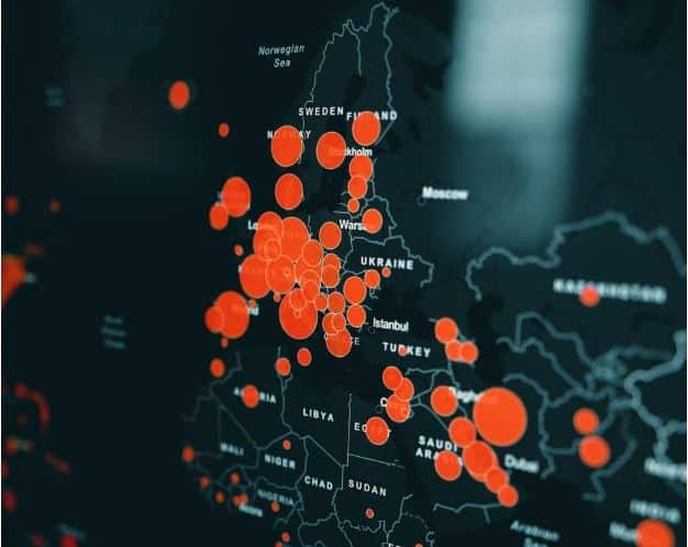
Geospatial data is a powerful tool that enables us to better understand our world with the power of location. In the geospatial field, we like to say that you don’t truly understand your data until you can analyze or visualize it from a geographic perspective.
This is why the geospatial industry is one of the fastest-growing and most exciting fields in data analytics, artificial intelligence, and machine learning engineers today.
You probably already know that GIS stands for Geographic Information System. However, do you know what the connection between GIS and data engineering is?
This article will introduce you to the world of data engineering in GIS so you can get started on your career as a geospatial data engineer or analyst. Readers can learn about the different roles in data engineering, what skills are required for each role, education paths, software tools used by data engineers in GIS, as well as how to get started with this career path if they so choose.
Read More: Big Data Courses and Certification
What is Geospatial Data Engineering?
Data engineering is a discipline that focuses on the process of designing, creating, and maintaining the systems that are responsible for moving and storing data. Data engineers are concerned with the entire data lifecycle, from acquiring raw data, through integrating and analyzing it, to the delivery of data-driven insights.
Data engineering is a critical component of the overall “data lifecycle management” (DLM) process and plays a key role in treating data as a product. But the other components are data science (creating insights from data) and data management (organizing and storing data).
Geospatial data engineers are responsible for the collection, integration, and storage of location-based data. As noted, the key difference is location. Data engineering in GIS is the process of transforming and preparing data so it can be consumed and analyzed by geospatial software.
Different Roles in Data Engineering in GIS
With new technology and innovation, the role of data engineers has been evolving for some time. But in general, data engineers are responsible for managing the data lifecycle, including collecting and ingesting data, cleaning and transforming data, integrating data, and storing data for future use.
There are many sub-roles within data engineering, and it is important to understand the differences between them.
- Data Ingestion – Data ingestion is the process of gathering and recording location-based data. Data engineers in GIS excel at collecting data, whether it is from sensors, surveys, or data entry.
- Data Extraction – Data extraction is the process of extracting data from a database or another data source. Data engineers in GIS use languages such as Python and SQL to extract data from a variety of data sources such as geodatabases or enterprise systems.
- Data Transformation – Data transformation refers to the process of modifying raw data so that it can be consumed by software. Data engineers in GIS use a variety of software to clean, filter, or transform data.
- Data Quality – Data quality refers to the state of the data and its fitness for use. Data engineers in GIS work with software to ensure that data is accurate and consistent.
Education Path for Data Engineers in GIS
Students who are interested in data engineering often choose computer science or a related field at the bachelor’s level. A bachelor’s degree in computer science, computer engineering, information systems, or a related field is often the minimum educational requirement for data engineers in GIS. Some employers may prefer candidates with master’s degrees in these fields.
There are also online data engineering certificate programs that include coursework in data structures, computer programming languages, algorithms, and big-data analysis. Many computer science programs also require students to complete a project or capstone project that provides hands-on experience with real-world data analysis problems.
As geospatial analytics continues to grow as a strategic business tool and more organizations begin to leverage location-based data, geospatial data engineering as a career is gaining new recognition. Overall, online education in data science has gained a lot of traction over the years for offering the most relevant digital skills for students.
Software Tools Used by Data Engineers in GIS
An important part of the job of a data engineer is choosing which tools to use when creating new applications or updating existing data pipelines. There are many different types of software developers, each with its own toolkit. As you read through this list, think about which tools would be most helpful for your particular situation or environment.
Apache Spark – Spark is an open source data processing framework that is widely used for steam processing and data analytics. If you want to start a career in data engineering, this should be in your top 10 data science tools to learn.
Snowflake – Snowflake allows data engineers to build data pipelines and facilitates high-performance workflows. Although Snowflake is not open source, it’s still one of the most popular options for data warehouses and data analytics.
FME – Feature Manipulation Engine (FME) is a data integration platform where you set up workbenches to ingest, transform (through transformers), integrate, and store geospatial data
ArcGIS Pro – ArcGIS Pro is the most recognized software in the GIS industry. Although functionality is still limited, it contains feature engineering tools to clean and integrate geospatial data.
Conclusion
If you love working with data, have excellent analytical skills, and thrive in a highly collaborative, team-based environment, the field of data engineering may be a great fit for you. But if you are interested in location-based data, then geospatial data engineering may be an even better fit for you.
As you’ve learned today, data engineers are a hybrid breed of engineers, data scientists, and computer programmers. They use their technical expertise to wrangle unstructured data, clean it up, and prepare it for analysis by data scientists. GIS data engineers just do it all spatially.
You can use this article to explore the different roles in data engineering and learn what skills are required for each role. You can also use this article to learn about the education path for data engineers in GIS and the software tools used by data engineers in GIS.


