Remote Sensing Data Analytics: How Satellites Make Agriculture Smarter
The modern agricultural landscape is a competitive field where farmers have to constantly push themselves towards new possibilities. And the use of innovative technology is a necessity on that road to success. The ongoing information revolution fuels advancements in crop yield and farm efficiency through precision farming techniques driven by vast amounts of data.
However, it all comes down to the quality of data sourced from sensors — devices facilitating remote sensing to gather crucial information about fields. This data, once collected, undergoes meticulous compilation and transformation into actionable insights using sophisticated data analytics. Therefore, such technology allows for the delivery of data tailored specifically to the individual needs of agricultural players, including the process of classification of crops using satellite derived data, which is critical for accessing the market based on the type of crop one plans to grow.
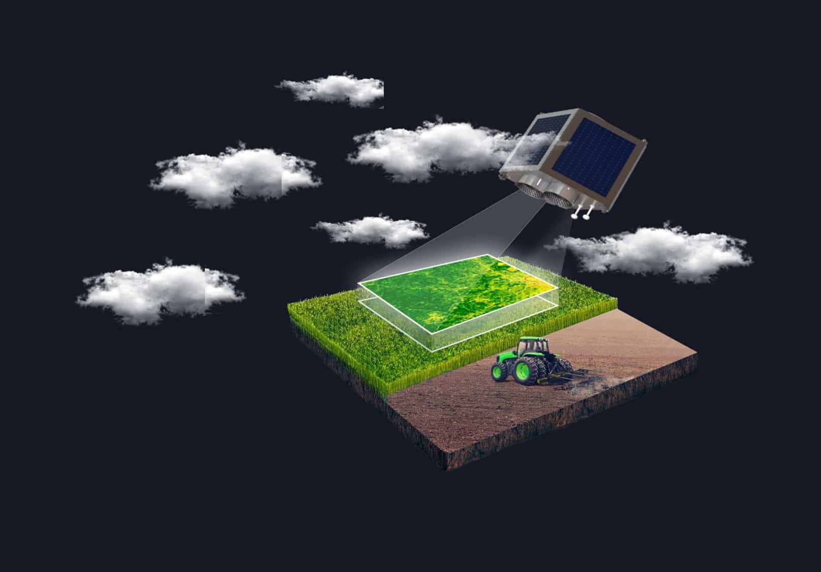
The biggest and one of the most used among the mentioned sensors are satellites orbiting our planet. Let’s see how these eyes in space help agronomists on Earth to make smarter decisions.
Ways Remote Sensing Satellites Benefit Agriculture
It was evident long ago that traditional photographic methods no longer satisfied farmers’ needs for information. Luckily, advancements in sensing technology have opened a possibility to delve into the realms of light, radiation, and heat through capturing diverse electromagnetic spectrum wavelengths. The accessibility of this equipment in agriculture has surged thanks to electronics miniaturization and the wide use of commercial drones. However, the main transformation occurred with the emergence of GIS, enabling organized data analysis and pattern recognition tied to specific geographic locations, such as agricultural fields.
Remote sensing devices play a critical role by continually capturing field data, empowering growers to analyze conditions and implement proactive measures for an optimal harvest outcome. These sensors function as an early warning system, alerting farmers to potential disease outbreaks and enabling timely interventions to mitigate damage. All in all, their capabilities span from assessing plant health and yield estimation to crop loss evaluation, irrigation management, weed detection, stress identification, and field mapping.
What makes satellites stand out compared to other sensors is their ability to provide a full picture of agricultural landscapes, which means the possibility of vast areas monitoring. Sensors aboard satellites capture multispectral and hyperspectral imagery, unlocking invaluable insights into crop health, moisture content, and nutrient levels. Analyzing this remote sensing data empowers farmers to make precise decisions, effectively optimizing resource allocation and enhancing overall farm management strategies. More so, satellites can provide historical data on all those parameters, allowing for smarter analytics and forecasting of future events.
Finally, to the most effective and commonly used benefits of satellite monitoring in farming.
Crop Health Tracking
By leveraging satellite data farmers can conduct continuous surveillance of their crop’s state across the entire growth cycle and numerous fields. Through the analysis of spectral information, growers gain insights into the initial indicators of stress, diseases, or nutrient insufficiencies. Armed with this timely data, they can plan relevant field activities, effectively targeting specific concerns to avoid plant damage and yield loss.
Crop Classification
Crop classification using remote sensing in agriculture is crucial for creating detailed maps showing what’s growing where. Using remote sensing data, particularly combining Synthetic Aperture Radar (SAR) with optical imagery, solves issues caused by cloud coverage or poor visibility. This fusion enhances accuracy, enabling identification of crop type even in challenging conditions, helping with inventory management, yield estimation, and transparent crop data for various purposes like compensation validation and market pricing.
Yield Prediction
Examining past satellite data alongside present crop conditions allows growers to make projections regarding potential yields. This serves as a cornerstone for refining harvesting schedules, determining storage needs, and devising effective market strategies. Moreover, this analytical approach enables farmers to pinpoint specific field areas needing extra care.
Irrigation Management
Satellite data analysis provides data on soil composition, moisture, and nutrient data to help identify areas needing additional fertilizers or water. Backed up with weather data, this allows for the creation of an efficient irrigation schedule, meaning the minimization of waste and ensuring optimal moisture levels for plant health.
Pest and Disease Detection
Utilizing remote sensing analytics, farmers can swiftly detect initial indications of pest invasions or diseases, enabling proactive measures to mitigate crop losses. This early warning system not only minimizes agricultural damage but also leads to more sustainable farming practices by cutting the need for excessive pesticide use.
Field Zoning
Satellite imagery analytics allows farmers to divide fields into several management zones based on a particular parameter. This precision farming technique allows for treating each acre according to its state and needs.
Wrapping it all up, satellite data analytics promises to keep elevating farming practices, granting farmers enhanced adaptability in an ever-evolving agricultural terrain and helping develop a sustainable and productive agricultural sector. It not only secures food resources but also minimizes environmental footprints. With satellite data as a guiding force, precision agriculture reshapes cultivation methods, leading toward a more intelligent and sustainable future in farming practices.
Related Posts

Building an AI-Ready Data Strategy: What Every Enterprise Should Get Right Before Scaling Artificial Intelligence
July 16, 2026Enterprise AI initiatives rarely stall because teams lack access to capable models. ...

What Social Media Analytics Actually Tell You – and What They Don’t
July 13, 2026If you work in data, you have probably watched a marketing team ...

Best 7 Revenue Intelligence Solutions for Technical Sales Teams
June 26, 2026Technical sales teams operate in a fundamentally different environment than most B2B ...

5 Best Social Intelligence Tools for 2026
June 15, 2026Social intelligence has become one of the most important capabilities for brands ...

The 2026 Data Observability Vendor Database: 20+ Platforms by Founding Year, Funding, Hosting, and Pricing
June 12, 2026The data observability market has evolved rapidly over the past five years. ...